This is the comprehensive Bukhansan hiking guide for Seoul tourists in 2026: every major trail, exact subway access, gear list, weather considerations, summit etiquette, where to fuel up before and after, and how to pick the right route for your fitness.
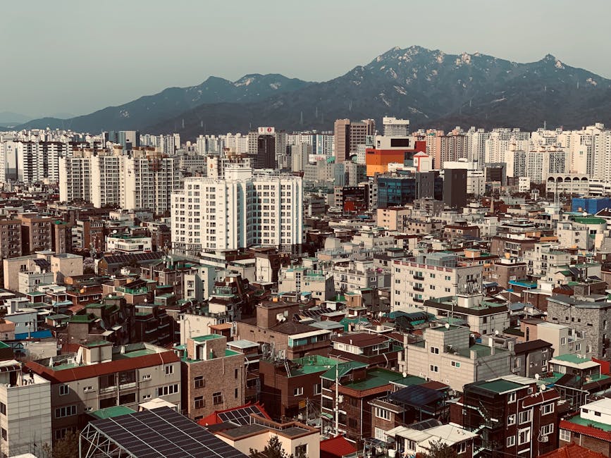
Why Hike Bukhansan?
- Highest point in Seoul — Baegundae Peak at about 836m
- Granite and heritage — granite slabs, ancient temples, fortress walls
- City views — panoramic Seoul, the Han River, Lotte Tower from summits
- Subway-accessible — Exit 2 of Bukhansan Ui Station (Ui-Sinseol line) is about five minutes on foot from the Seoul Hiking Tourism Center, and from Gupabal (Line 3) a bus runs to the Bukhansanseong entrance
- Free entry — the national park charges no admission
- A big day hike to the summit, with gentler trails lower down
- Year-round — even snow-covered, with proper gear
Bukhansan At a Glance
| Detail | Info |
|---|---|
| Highest peak | Baegundae (approx. 836m) |
| Other major peaks | Insubong (810.5m), Mangyeongdae (799.5m) |
| Total area | 79.92 km² |
| Best season | October (autumn foliage), April–May (spring) |
| Difficulty (Baegundae) | Moderate to moderately hard |
| Hiking time (Baegundae) | Most of a day, depending on route and pace |
| Entrance fee | Free |
The 4 Best Hiking Routes
1. Baegundae Peak from Doseonsa Temple Route
The climb from the Ui side via Doseonsa is part of the Baegundae–Ui Gugok route, which the Seoul Hiking Tourism Center calls the shortest trail to Seoul’s highest point. Starts on the eastern side of the park.
- Trailhead: Bukhansan Ui Station (Ui-Sinseol Light Rail) → uphill walk to the trailhead
- Time: about 4 hours 20 minutes of walking, per the official hiking map
- Elevation gain: a steep climb to the summit
- Difficulty: Advanced on the official hiking map (granite section near summit)
- Best for: Hikers with good fitness
2. Baegundae from Bukhansanseong Fortress Entrance — The Classic Route
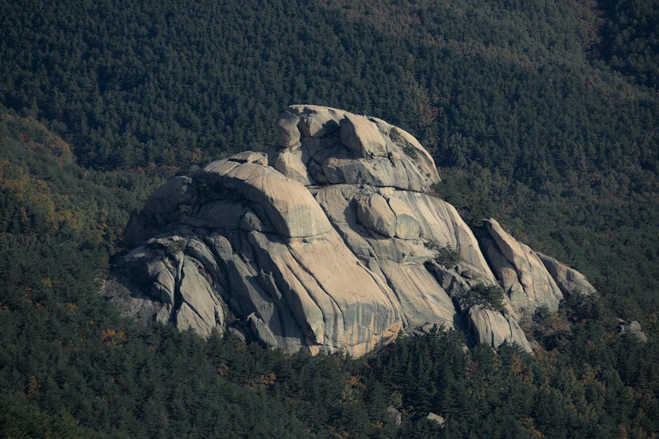
Splits halfway, allowing choice between longer/easier and shorter/harder finishes.
- Trailhead: Gupabal Station (Line 3), Exit 2 → bus 34 to Bukhansanseong (confirm the current route on Naver Map before you set off)
- Length: a long, demanding route, so start early
- Difficulty: Moderate to moderately hard
- Best for: Most travelers; the most scenic option
3. Insubong Peak — The Climber’s Route
Insubong is the technical peak — granite walls draw rock climbers worldwide. Hiking to its base is achievable; climbing the summit requires gear and experience.
- Difficulty: Moderate
- Best for: Climbers and adventurous hikers (with permits/guides)
4. Mangyeongdae & Bukhansan City Wall Loop — The Cultural Route
Follows the Joseon-era walls of Bukhansanseong, the mountain fortress, past temples and historical structures. Less summit, more history.
- Difficulty: Easy to moderate
- Best for: Travelers who want the views without the full summit grind
The Final Push to Baegundae Summit
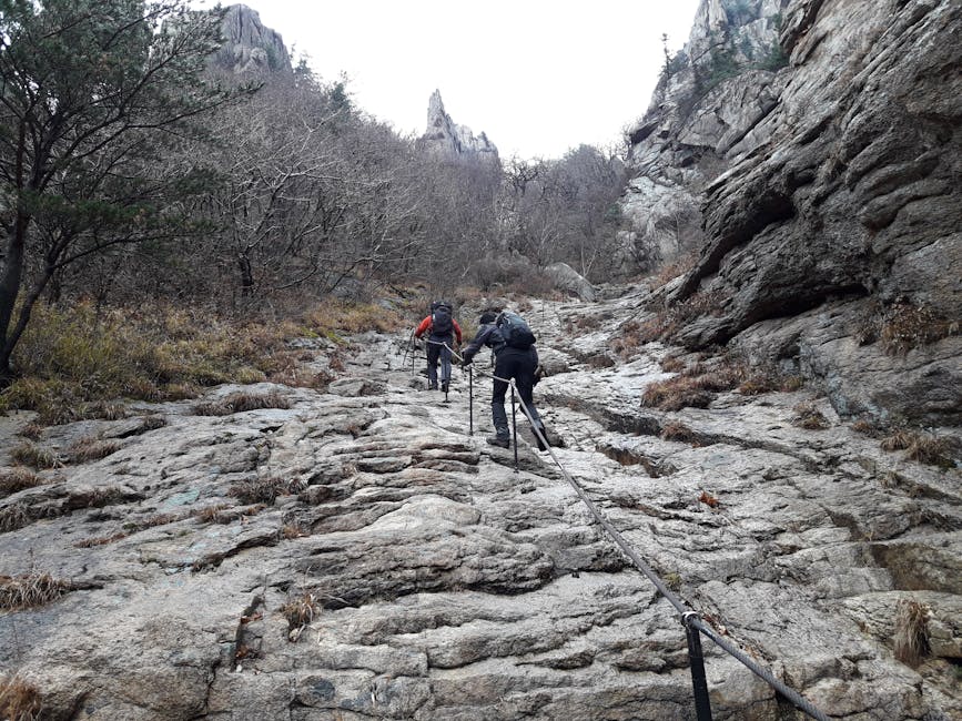
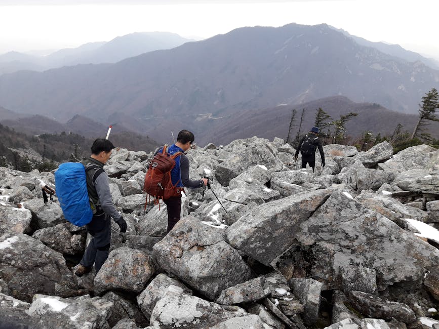
The last stretch to Baegundae’s summit is where the route earns its reputation. Steep granite slabs, handrails, narrow passages, and a queue of hikers waiting their turn (especially on weekends). The terrain isn’t technical mountaineering, but it requires:
- Focus and patience
- Comfort with mild exposure (steep drops beside the rock)
- Hands-free hiking poles or stowed for the handrail sections
- Grippy soles for granite friction
- Extra time for the final summit pitch on busy days
Avoid weekends if possible. If a Saturday or Sunday is your only chance, build spare time into the day for the final section.
How to Get to Bukhansan from Seoul
To Bukhansan Ui Station Trailhead
- Take Line 4 to Sungshin Women’s University (성신여대입구) Station, transfer to Ui-Sinseol Light Rail
- Get off at Bukhansan Ui (북한산우이) Station
- Leave by Exit 2; the Seoul Hiking Tourism Center is about five minutes away, and the Doseonsa Temple trailhead is further on, uphill
To Bukhansanseong Fortress Trailhead
- Line 3 to Gupabal (구파발) Station, Exit 2
- Bus 34 to Bukhansanseong (북한산성)
To Hwagyesa Trailhead (via Suyu Station)
- Line 4 to Suyu Station (check the exit on the station map)
- Local bus from Suyu Station to Hwagyesa Temple (look up the number on Naver Map)
See our Seoul subway guide for general transit help.
What to Pack
- Sturdy hiking shoes or trail runners — granite is slippery when wet
- 2L water minimum per person
- Lunch + snacks (no food vendors past trailhead)
- Sunscreen + hat (sun is intense at altitude)
- Light layers — the summit is cooler than the trailhead
- Rain jacket (Korean weather changes fast)
- Trekking poles recommended for downhill
- Phone with offline map (Naver Maps offline)
- Cash for post-hike makgeolli (₩6,000–8,000 per bowl)
- Toilet paper — public restrooms have basics but supplement
- Headlamp if late finish possible
Best Time of Year for Bukhansan
Autumn (October–November) — Peak Season
Crisp days, golden ginkgo and red maple. Trails are crowded but the views are unbeatable. Mid-late October peaks.
Spring (April–May) — Cherry Blossoms
Cherry blossoms along the lower trails in early-mid April. Cooler than autumn; sometimes rainy. Wildflowers along ridges in May.
Summer (June–August) — Avoid Midday
Hot, humid, occasional thunderstorms. Start at 6:00 AM to summit before noon heat. Rainy season (jangma) late June-July. On the jangma days when wet granite rules out the summit pitch, swap the mountain for the river — cycling the Han River bike paths is flat and largely traffic-free, and a Ttareungi one-day pass costs ₩1,000 for repeated rides of up to 60 minutes each; dock the bike before each hour is up to avoid extra charges.
Winter (December–March) — Snow Hikes
Snow-covered granite slabs become technical. Crampons (microspikes) recommended for the summit section. Beautiful but for experienced hikers only.
Suggested Bukhansan Itinerary
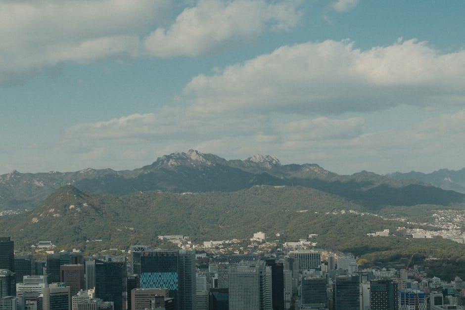
Full Day Bukhansanseong-to-Baegundae
- 6:30 AM — Subway to Gupabal Station
- 7:15 AM — Bus to Bukhansanseong
- 7:45 AM — Trailhead start, light breakfast
- 10:30 AM — Reach Yongam-mun Gate / fortress wall
- 12:30 PM — Summit Baegundae Peak — lunch break
- 1:30 PM — Descend
- 4:00 PM — Return to Bukhansanseong trailhead
- 4:30 PM — Bus to Gupabal
- 5:30 PM — Pajeon (green-onion pancake) + makgeolli at trailside restaurant
- 7:00 PM — Return to hotel for spa/recovery
That is a full day committed, which matters when you are rationing a short trip: Bukhansan competes directly with the best day trips from Seoul — Suwon’s Hwaseong fortress, the Nami Island and Gapyeong run, Incheon’s Chinatown. With a week in the city you may only fit two, and the strongest rival is a DMZ tour to the Third Tunnel, which also swallows a whole day and starts early; check your tour’s pickup or meeting time when you book.
Trail Map and Navigation
- Naver Maps — most accurate; download offline before
- KakaoMap — alternative
- AllTrails — English route guides with elevation profiles
- Park visitor center at Bukhansanseong has English maps
- Trail signposts are bilingual (Korean + English) on major routes
Bukhansan Temples on the Trail
Several Buddhist temples sit within the park, accessible from main trails:
- Doseonsa Temple — at one trailhead; 1,000+ year history
- Hwagyesa Temple — international Zen center
- Jingwansa Temple — famous for templestay + temple cuisine — see our Seoul temples and shrines guide
- Sangunam Hermitage — small, atmospheric
Post-Hike Korean Tradition: Pajeon + Makgeolli
Korean hiking tradition mandates a post-hike pajeon (green-onion pancake) + makgeolli (Korean rice wine) at one of the dozens of trailside restaurants. Most cluster around the Bukhansanseong and Bukhansan Ui entrances.
- Pajeon: ₩12,000–18,000 (shared)
- Makgeolli bowl: ₩6,000–10,000
- Tofu kimchi: ₩10,000
- Korean BBQ: ₩45,000–80,000 for 2 people
Bukhansan Hiking Etiquette
- Yield to descending hikers in narrow sections
- Don’t bring outdoor speakers (Korean hiking is generally quiet)
- Pack out all trash — strict carry-in/carry-out
- Stay on marked trails — fines for off-trail hiking
- Don’t bring drones — restricted in park
- No camping outside designated sites
- Bow to summit markers — Korean hiker tradition
Safety Tips
- Start early — sunrise is best, summit by noon
- Tell someone your route + expected return
- Check weather — typhoon and thunder warnings close trails
- Phone charged — call 119 for rescue or medical help wherever you have a signal
- Hike with a buddy for the granite summit section
- Avoid the route in heavy rain — granite becomes slippery
- Cap on summit climbers — Baegundae final pitch sometimes turns hikers around on extreme weekends
- Park rangers on duty during daylight
Easier Bukhansan Alternatives
If Baegundae sounds intimidating:
- Hyangno Peak — a lower summit than Baegundae
- Bukhansan Dulle-gil — about 70 km of marked trails around the base of the mountain, low elevation; with children, pick one of the gentler sections
- Inwangsan (338m) — Seoul city wall hike, easier mountain just south of Bukhansan
- Namsan (262m) — central Seoul mountain, paved paths, N Seoul Tower at top
And if you would rather drop the elevation entirely, Seoul’s flatland green space is worth a morning of its own: Seoul Forest spreads over 450,000 m² of Seongsu with a deer enclosure and ecological wetlands, and Olympic Park’s ginkgo avenues turn the same week the Bukhansan maples do. Our roundup of the best parks and gardens in Seoul covers twelve of them.
See our Seoul outdoor & nature guide for more options.
Where to Stay Near Bukhansan
Most travelers day-trip from central Seoul. Hotels near subway lines for easy morning access:
- Insadong/Anguk — Line 3 direct to Gupabal trailhead
- Myeongdong — Line 4 to Suyu
- Hapjeong — Line 6 connections
- Templestay at Jingwansa or Hwagyesa within the park
See our where to stay in Seoul guide.
Bukhansan is a superb mountain you can reach on the subway, but if it gives you a taste for granite, the next step up is Seoraksan National Park on the east coast. It is a long day by bus, and our guide compares the Ulsanbawi climb, the cable car and the easy valley walk for anyone going.
Frequently Asked Questions
How hard is Bukhansan hiking?
Moderate to moderately hard, depending on the route. You need reasonable fitness and an early start. The final summit section means climbing steep granite slabs with handrails.
How long does it take to hike Bukhansan?
It depends on the route and your pace. The Baegundae round trip fills most of a day, and the circuits lower down are shorter.
Is Bukhansan free?
Yes — national park entry is free. Getting there costs only standard subway and city bus fares.
How do I get to Bukhansan from Seoul?
Subway Line 3 to Gupabal + bus, or the Ui-Sinseol Light Rail to Bukhansan Ui Station (change from Line 4 at Sungshin Women’s University).
Best time to hike Bukhansan?
Mid-late October for autumn foliage; early-mid April for cherry blossoms. Avoid summer midday.
Should I avoid weekends?
Yes if possible. The Baegundae summit pitch develops bottleneck queues; daily climber caps may apply during peak weekends.
What gear do I need?
Hiking shoes, 2L water, snacks, layers, rain jacket. Trekking poles helpful. Crampons in winter.
Are the trails marked in English?
Major trail signposts are bilingual. Naver Maps and AllTrails English versions help.
Can I hike Bukhansan in winter?
Yes with proper gear (microspikes for granite slab in snow). The summit section becomes technical.
What’s the post-hike food tradition?
Pajeon (green-onion pancake) + makgeolli (Korean rice wine) at trailside restaurants. ₩20,000+ for two.
Final Thoughts
Bukhansan delivers one of the most rewarding day hikes in any major world city. A subway ride from your Seoul hotel can put you on a granite summit at 836 meters with panoramic views over the entire metropolis. With proper preparation and timing, even moderately fit travelers can summit Baegundae and be back in time for dinner. Pair this with our Seoul outdoor & nature guide, our temples & shrines guide, the things to do in Seoul hub, and the master Seoul travel guide.